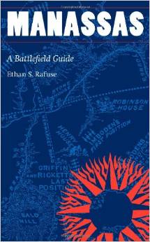
Manassas: A Battlefield Guide by Ethan S. Rafuse. University of Nebraska Press, 2014. Paper, ISBN: 978-0803236431. $21.95.
 Ethan S. Rafuse’s Manassas: A Battlefield Guide is a latest volume in the University of Nebraska Press’s excellent “This Hallowed Ground” Series—short guides that profile important Civil War battlefields. (Previous editions have brought to life the fields of Gettysburg, Chickamauga, Shiloh, Wilson’s Creek, the Peninsula Campaign, and the Maryland Campaign).
Rafuse’s guide offers readers a recommended eight-hour driving and walking tour of the First and Second Battles of Manassas (July 21, 1861, and August 28-30, 1862). It includes fourteen primary driving tour stops (six for the first battle and eight for the second), and all of these driving stops include one or more “sub-stops”—walking stops that explore the fighting in the vicinity of the parking location. Additionally, Manassas includes seventeen optional “excursions,” driving stops for more ambitious battlefield trampers who do not mind exploring more far-flung locations in order to reach the understudied engagements and maneuvers of the two Manassas Campaigns. The optional excursions take tourists to such locations as Blackburn’s Ford, Kettle Run, Cedar Mountain, and Chantilly.
Like its forerunners, Manassas follows a standard format. Each stop (or sub-stop) contains four sections: “Directions” (which tells a visitor how to reach the location in question), “Orientation” (which acquaints the visitor with the nearby terrain features), “What Happened” (which narrates the battle action at that location), “Analysis” (which evaluates the significance of the battle action), and “Vignette” (which offers a colorful anecdote associated with that stop).
As with the other guides, Manassas’s format is a model of perfection. Directions are clear and precise, the orientation is understandable, and the narrative and analysis sections are accessible, illuminating, and cleverly written. Battlefield trampers who have utilized the other guides should expect more of the same high quality material. In short, the editors of the “This Hallowed Ground” series have identified a niche, and they continue in their model of explaining Civil War battlefields.
However, the Manassas volume makes a few departures that separate it from the other guides. Most obviously, Manassas utilizes a new cartographer, Erin Greb, whose maps differ markedly from her predecessor, Christopher Brest. Greb’s maps blend battle action, historic terrain features, and modern roads into a single image, just as the Brest’s maps had done; however, Manassas’s maps provide a higher degree of detail. They contain more topographical detail, including fine-tuned lines of elevation, and their labels are more numerous and more exact, especially in reference to military units. Experienced battlefield trampers will undoubtedly find these improvements refreshing; however, they may tend to dampen the interest of introductory-level battlefield enthusiasts who might find the detail a little too confusing.
Disappointingly, Greb’s maps rarely delve into a narrow scale. Most of the tactical maps spread across a distance of two miles or more in all directions. While this broad scope does well to put the various arenas of combat into proper context, it makes it exceedingly difficult to understand the flow of battle within a narrower compass. This deficiency becomes most obvious at the Chinn Ridge Stop (7a-7b). Late on the afternoon of August 30, 1862, seven Confederate brigades slammed into five Union brigades on a low ridge that spanned a distance of no more than a half-mile. The two maps that accompany the Chinn Ridge stop are held at such a large scale that almost nothing about the flow of the action can be gleaned from them. Similar complaints might be made of other maps, including First Manassas’s Matthews’s Hill map (2a-2b), and Second Manassas’s Grover’s attack map (2b), Porter’s attack on the Deep Cut map (Stops 5a-5b), the Texas Brigade’s assault on Warren’s brigade map (6a-6c), and Pope’s last line on Henry Hill map (8c). To bring the battlefield to life, all of these maps require a tighter scale.
In addition to the new arrangement for maps, Manassas sports an altered format for the “Vignettes” section. In the other volumes, the anecdotes were shorter and offered explanatory detail written by the author. In Manassas, the anecdotes are longer and are essentially cut-and-paste jobs; they include several paragraphs of material written by a participant. These long primary accounts will likely appeal to battlefield buffs and staff ride leaders, but these will not likely interest first-time battlefield tourists who want something succinct and written in modern vernacular. In short, the vignettes read less like a shallow human-interest story and more like a veteran telling his biased view of the battle.
Perhaps one of the most unfortunate shortcomings—and it is one that has existed since the beginning of the “This Hallowed Ground” series—is the continued reliance on artwork from Battles and Leaders as filler material. In Manassas, some of the artwork has been misused or carelessly labelled. For instance, an image on page 51 (First Manassas Section) entitled, “Captured by Stonewall Jackson Himself” comes from a Battles and Leaders chapter on the Battle of Gaines’s Mill, an engagement irrelevant to the story of the July 21 battle.
In general, the images tend to fill only portions of the pages, leaving large amounts of unfilled space. Excepting images of general officers, most of the images are either irrelevant, or too tersely captioned to be appreciated. On page 210, for instance, readers get a glimpse of a Union soldier standing by a railroad track. The image is simply labeled, “a disorganized private.” The book fails to point out that the image derived from a Timothy O’Sullivan photograph taken in late-August 1862 that showed Union soldiers observing the wreckage of Stonewall Jackson’s attack against Manassas Junction, an event exceedingly relevant to the author’s narrative.
Strangely, Manassas does not even select the most relevant images from Battles and Leaders. Instead of incorporating images of landmarks such as the Sudley Springs Road (1: 186), the Stone House (1: 232), the Deep Cut (2: 508), the Stone Bridge (2: 506), Groveton Corners (2: 518), and Thoroughfare Gap (2: 514), or famous events such as the death of Philip Kearny (2: 537), the Battle of Brawner Farm (2: 468), or the Battle of Cedar Mountain (2: 456), the book contains generic images of soldiers marching, skirmishers in the woods, or cavalrymen mounted on horseback. Altogether, the maps and images present an inconsistency. The level of detail in the maps suggests that the author meant for the book to attract a seasoned tramper, but the irregular stock imagery suggests that guide was meant to target an introductory-level audience.
These criticisms aside, readers should expect a good tour and an exciting hike. They will go off the beaten path and visit the famous sites of the two Manassas battlefields. Following this guide reminds readers that one of the best ways to study the war is by leaving our couches and seeing the field for ourselves.
Timothy J. Orr is Assistant Professor of History at Old Dominion University and the editor of Last to Leave the Field: The Life and Letters of First Sergeant Ambrose Henry Hayward (2011).